Navigation technology guide
Robot Mower Navigation Technology
Boundary control, positioning, mapping, obstacle handling, and connectivity are separate jobs. Current robot mowers mix those jobs in different ways.
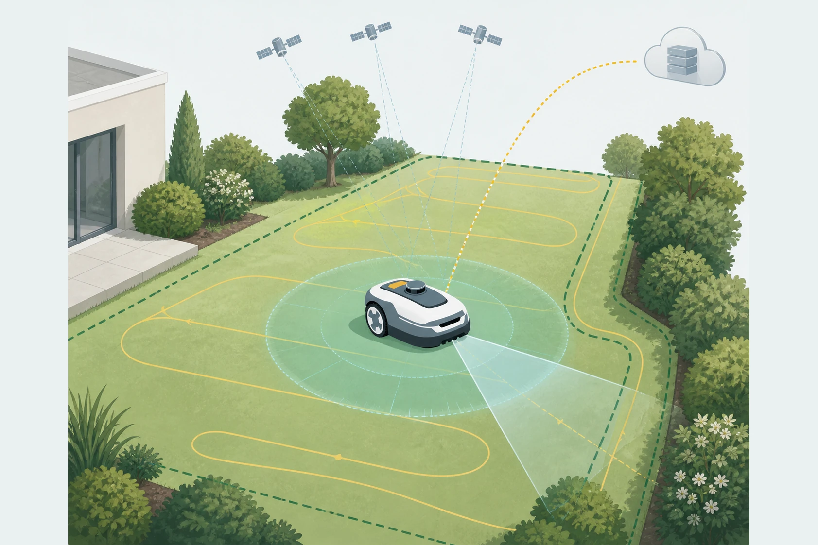
Boundary control is only one layer.
A boundary wire answers one question: where is the mower allowed to work? Wire-free systems answer that same question with positioning, mapping, and correction services. Neither answer is the whole navigation story on its own.
That is why a property-first read matters. A lawn with separated zones, tree cover, narrow passages, or weak sky view can make the same mower look easy on one property and awkward on another.
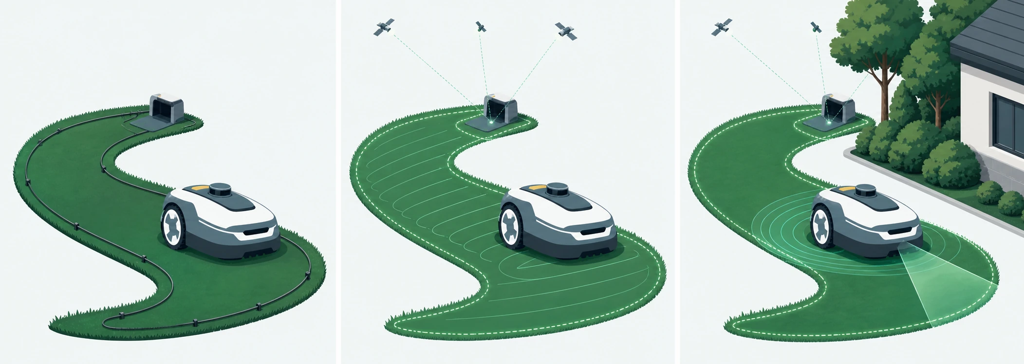
- Physical-wire systems place the boundary in the yard.
- RTK and Network RTK systems place more of the boundary logic in the setup and signal environment.
- LiDAR and vision describe how the mower perceives surroundings, not whether it is wired or wire-free.
Positioning and mapping decide how flexible the mower feels later.
Positioning is about knowing where the mower is. Mapping is about turning that position into zones, channels, no-go areas, and recoverable routes. Those are related, but they are not interchangeable.
In the official US materials reviewed for this guide, Mammotion describes the LUBA 3 AWD 3000/5000 variants as a Tri-Fusion stack built around LiDAR, NetRTK, and AI vision. Segway Navimow describes the X4 family as tri-frequency Network RTK plus 360-degree VSLAM/VIO and AI VisionFence, with a bundled antenna path when Network RTK is not available.
The immediate lesson is practical: a “wire-free” label is not enough. The reader still needs to ask whether the system depends on network correction coverage, bundled local hardware, or both.
Obstacle detection and connectivity belong in the same discussion.
Obstacle handling is part sensor stack and part route behavior. Connectivity is about whether the mower can keep its correction data, remote control features, or tracking services active after setup day. Those questions meet at the dock and across the whole property.
- LiDAR and vision can help the mower understand trees, structures, and changing scenes.
- Satellite-correction systems need clear enough operating conditions and may depend on service entitlements.
- Remote-control or tracking features often use a separate 4G subscription path from the core positioning service.
| Field | Boundary and position role | Mapping and sensing role | What to watch on a real property |
|---|---|---|---|
| Physical wire | Defines the edge directly with buried or pinned wire. | Works without satellite correction, but the property has to be physically traced. | Useful where sky view is difficult, but boundary edits become a yard project instead of an app change. |
| Network RTK | Keeps the property wire-free by using correction data instead of a boundary wire. | Needs reliable correction coverage and enough sky view for the mower to keep position. | Best when the property wants fast remapping, but the setup stays dependent on coverage terms and signal conditions. |
| LiDAR | Does not replace boundary logic on its own, but it improves spatial awareness. | Builds distance-based surroundings data that can support positioning and route recovery. | Helpful around trees and structures, but it still needs to be paired with the mower’s boundary and positioning system. |
| Vision and VSLAM/VIO | Camera systems do not define the border by themselves unless the mower’s full stack supports that workflow. | Vision systems help the mower understand landmarks, motion, and scene changes. | They can improve mapping and obstacle handling, but performance is still conditional on lighting, clutter, and the rest of the stack. |
| Hybrid stacks | Blend wire-free boundary control with multiple positioning and sensing layers. | Combine satellite correction, LiDAR or camera sensing, and onboard sensors instead of relying on one input. | Current flagship wire-free mowers often live here, which is why “RTK mower” is usually an incomplete description. |
Current examples
The official US materials reviewed for this guide do not support a universal winner between wire, RTK, LiDAR, vision, or hybrid systems. They support a narrower conclusion: the best fit depends on how the property, setup conditions, and long-term service terms line up with the mower’s navigation stack.
- Mammotion’s current US materials separate the LUBA 3 AWD 1500 from the 3000/5000 variants on RTK and NetRTK capability.
- Navimow’s current US materials separate Network RTK from Connect+, so “built-in 4G” is not a complete ownership answer by itself.
- Both examples show why the documented conditions matter more than a single buzzword on the box.
Sources
Official sources
These links point to the manufacturer or support sources used for the page.
- LUBA 3 AWD robot lawn mower
Current US product page covering coverage tiers, variant labels, navigation claims, included hardware, and family FAQs.
- LUBA 3 AWD Series User Manual - EN
Official support entry for the current LUBA 3 AWD series user manual.
- Mammotion charging station installation guide
Official charging-station setup guidance covering flat placement, clearances, sky view, secure mounting, and docking tests.
- Navimow X4 robot lawn mower
Current US X4 product page covering X430, X450, navigation, slope, included hardware, and Connect+ terms.
- Navimow X4 Series US user manual
Official US user manual with battery, charging, dimensions, sensors, and dock guidance for X4 series.