
Lawn planning guide
Robot Mower Lawn Assessment
Measure the lawn, identify the difficult parts, and carry those notes into navigation and model comparisons.
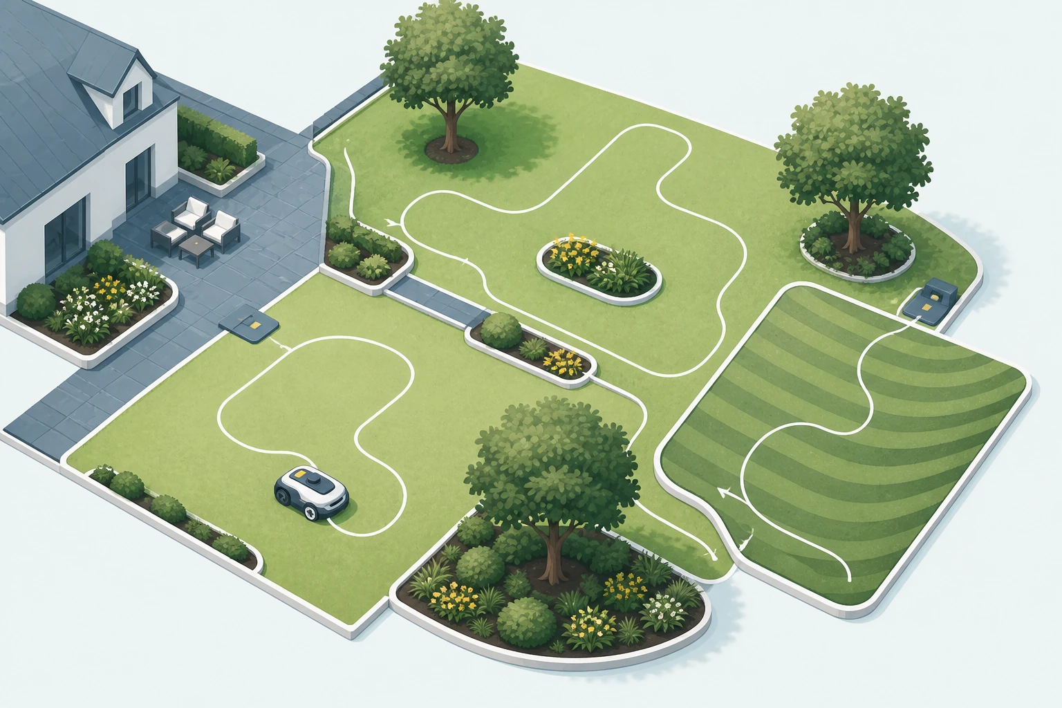
Measure the mowing area
Start with the grass the mower will actually maintain. Exclude the house, beds, hardscape, ponds, and areas that will remain outside the map. A property lot size is not the same as a mowing area.
- Estimate each separate grass area rather than one rough total.
- Mark the longest routes between the dock and distant zones.
- Note sections that can only be reached through a gate or narrow channel.
- Record areas that regularly stay wet, soft, or obstructed.
Map zones and passages
Sketch each mowing zone and the path connecting it to the next. Measure passage width at the narrowest point, including edging, roots, posts, and anything that reduces usable travel space.
Separate three questions: whether the mower can be mapped into the zone, whether it can travel through the passage, and whether it can return to the dock without a manual move. Product zone counts do not answer passage and route questions.
Record slopes and boundaries
Mark where slopes begin and end, which direction the mower would travel, and whether the grade sits inside a zone, along a boundary, or near a turn. Manufacturer maximums can use different conditions, so keep the property measurement separate from the headline specification.
- Measure the steepest section rather than averaging the full lawn.
- Note side slopes and transitions as well as straight climbs.
- Mark drop-offs, walls, water, roads, and other boundaries that need conservative planning.
Check trees and sky view
Trees affect more than obstacle handling. Trunks, low branches, dense canopy, buildings, and narrow side yards can change the signal environment and the available route. Walk the property while looking at both mower level and the open sky above it.
For wire-free systems, confirm whether the address has the required network correction coverage and whether the included or optional local antenna has a workable location. Vision and LiDAR can support the navigation stack, but they do not remove every positioning and boundary requirement.
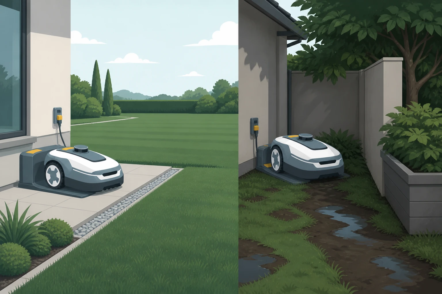
Choose dock candidates
Identify at least two possible dock locations. Each candidate needs suitable power, stable ground, drainage, approach space, and a practical route into the first mowing zone.
- Check cable reach and weather-protected power arrangements.
- Keep the approach free of tight turns and regular obstructions.
- Check model-specific clearance and sky-view instructions.
- Plan how the mower will leave and return without crossing excluded areas.
Use the charging and dock-placement guide for the next step.
Use the assessment
Carry the completed sketch and measurements into the buyer’s guide. They provide a practical filter for acreage, navigation, slope language, included positioning hardware, dock requirements, and package choices.
Sources
Official sources
These links point to the manufacturer or support sources used for the page.
- LUBA 3 AWD robot lawn mower
Current US product page covering coverage tiers, variant labels, navigation claims, included hardware, and family FAQs.
- LUBA 3 AWD Series User Manual - EN
Official support entry for the current LUBA 3 AWD series user manual.
- Mammotion charging station installation guide
Official charging-station setup guidance covering flat placement, clearances, sky view, secure mounting, and docking tests.
- Navimow X4 robot lawn mower
Current US X4 product page covering X430, X450, navigation, slope, included hardware, and Connect+ terms.
- Navimow X4 Series US user manual
Official US user manual with battery, charging, dimensions, sensors, and dock guidance for X4 series.